The Crested Butte News Serving the Gunnison Valley since 1999


National Weather Service delivers outlook
Break out the sunscreen–it may be a dry, warm winter in Colorado. The National Weather Service has just released its winter weather outlook for 2007/2008 and the forecast isn’t looking good.
This winter, the “La Niña” phenomena will prevail and could have a strong effect on local weather patterns.
According to the report’s outlook on temperatures in Colorado, “The odds strongly favor above-normal temperatures,” in addition to less-than-average precipitation. Those weather trends are expected to become more prevalent as winter progresses.
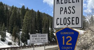
Northwest portions of the state may get a little more snow than average, while the mountains in the southwest (including the San Juans and West Elks) are expected to get significantly less. However, the report concedes, “There is typically less confidence in the long range forecast for precipitation than for temperatures.”
A slight shift in the jet stream during storm events could cause additional precipitation in Colorado, the report says, but such a change wouldn’t provide more precipitation than normal.
The winter of 1998/1999 had a La Niña event. “That winter southeast Utah and southwest Colorado only received 30 to 60 percent of normal precipitation,” according to the report.
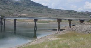
According to Upper Gunnison River Water Conservancy District manager Frank Kugel, SNOTEL monitoring data shows a reduced snow pack during fairly moderate La Niña years of the past. The good news, Kugel says, is that Taylor Park and Blue Mesa Reservoirs are currently above their normal levels. “This will lessen the likelihood of downstream calls affecting the upper Gunnison basin in 2008,” Kugel says.
Crested Butte Avalanche Center director Alan Bernholtz, who says he has no formal background in meteorology, says a side effect of the warmer temperatures could be slightly increased snowfall mid-winter. Bernholtz says this is “due to the air mass being able to hold more liquid… Sometimes it gets so cold there’s no moisture in the air.”
The potential for avalanches probably will not be affected by either warmer temperatures or less-than-average snow, Bernholtz says.
A La Niña occurs when the surface temperature of water in the Pacific Ocean is colder than average, causing changes in evaporation and wind patterns. Where an “El Niño” event pushes the jet stream farther south and often comes with more precipitation, a La Niña pushes the jet stream to the north, littering the northern latitudes with snowstorms.
For more information about the winter weather outlook or La Niña, visit www.cpc.ncep.noaa.gov/top_ten.shtml.