The Crested Butte News Serving the Gunnison Valley since 1999


More than 1,000 miles of data collected
By Burke Minsley, Research Geophysicist, Crustal Geophysics and Geochemistry Science Center, USGS
The United States Geological Survey finished its survey of the valleys around Crested Butte in early November. The survey was conducted by Geotech, a company that specializes in airborne geophysical surveys, using an AStar 350 B3 helicopter based out of the Gunnison airport. More than 1,200 miles of data were successfully collected.
The primary instrument was an electromagnetic sensor that was towed about 100 feet beneath the helicopter, and resembled a large hula-hoop. The electromagnetic sensor measured the electrical resistivity of the earth to depths several hundred feet below-ground. Different rocks and sediments have different electrical properties, so that information can be used to efficiently map subsurface geology over large areas. Radiometric and magnetic measurements were also taken to improve interpretation of the data.
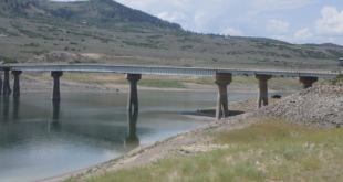
The data will be used to generate a three-dimensional view of the local geology. For example, a 5.5 km-long cross-section of electrical resistivity along one flight line just north of Crested Butte (see photo) extends our knowledge from existing maps of surface geology hundreds of feet into the subsurface. Here, low resistivity values likely represent the Mancos shale, while higher resistivity values represent overlying sediments.
USGS geophysicists will work through spring to translate the data into three-dimensional maps. The information will be released to the public and be used as part of other research to understand groundwater flow and other processes in mountain headwater systems.