The Crested Butte News Serving the Gunnison Valley since 1999


Seismic testing; 787 million gallons of water discussed
By Cayla Vidmar
A plan to develop more gas wells in the North Fork Valley west of Crested Butte would come with lots of water use for fracking, and explosive testing to utilize seismic mapping to find the resource.
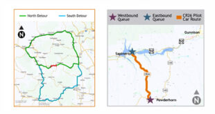
Gunnison Energy, LLC (GE) gave a broad update to the Gunnison Board of County Commissioners this month, including the revised proposed action plan for the North Fork Mancos Master Development Plan (NFMMDP) and an overview of seismic testing. The new activity would be located on the other side of Kebler Pass in Gunnison County near Paonia.
The revised NFMMDP includes 35 new natural gas wells and a significant increase in water use in the first four years of drilling, to the dismay of local environmental groups. Representatives from GE also gave a broad overview of seismic testing, a process that would be used in the company’s Iron Point and Trail Gulch seismic projects located near Paonia.
The revised plan increases the amount of water used for drilling and other uses from 5.8 acre-feet to 67.3 acre-feet per well, or about 767 million gallons. Other concerns for the proposal include increased truck traffic for hauling water.
“We believe in the rock, it’s world-class rock,” said Salar Nabavian, Gunnison Energy general manager, explaining some of the intricacies of the Piceance Basin, in northwest Colorado, into which the 35 wells would be drilled.
In the initial proposal for the 35 new well sites, GE intended to use a nitrogen foam method to hydraulically fracture the bedrock. Later, it was determined this process would be unfeasible, and GE “now proposes to use the most widely used and most reliable method of HF [hydraulic fracturing], referred to as the slickwater method,” according to the revised preliminary environmental assessment (EA).
This method uses significantly more water than the initial proposal, going from 3.9 acre-feet of water per well to 64.4 acre-feet per well. This estimate increases with the addition of water for other uses, including dust abatement, to approximately 21 million gallons of water per well.
Matt Reed, public lands director for High Country Conservation Advocates, deems that amount of water “staggering” in a letter addressed to the BOCC. In his letter, Reed compares this amount of water use to that of a typical household, which, according to the Colorado State University, is 0.4 to 0.5 acre-feet per household per year, including lawn maintenance. “This 35-well project would use a mind-boggling 2,355 acre-feet of scarce West Slope water, or 767,380,114 gallons,” the letter states.
During the BOCC presentation, Nabavian and GE regulatory supervisor Jessica Donahue addressed questions directly from Reed about the increase in water use.
“The water we’re going to be using, the majority of it will be coming from our augmented water source from Oxbow,” said Nabavian, who stated the company owns an estimated 1.7 million barrels of water. The Oxbow Group is a parent company of GE, founded by William Koch.
“Our intent is that the first year we will use more fresh water, and as we progress and develop, we will add additional storage so that all the water coming out of the wells can be recycled and we can reduce our fresh water use over time,” said Donahue. She later explained the company is looking at “more creative options in the area to use more recycled produced water than fresh water.”
According to the revised EA, “Approximately 83 percent of the total water would be first-used fresh water from surface sources.” Nabavian explained during the presentation that about 10 percent of the water used would be trucked to the well sites, and would be purchased from the city of Delta.
“Trucking of water would occur on 50 to 60 days of late summer and fall, and would result in approximately 42 round-trips per day across 24 hours on haul-days,” according to the revised EA. Donahue explained the hope is to have “enough produced water and enough local fresh water that we won’t have to purchase water and we won’t have those trucks at all.”
During the presentation, Nabavian said, “Our focus is keeping trucks off the road,” noting that the company will not be trucking inside city limits of Paonia or Hotchkiss, and that they “don’t want to disrupt the Highway 133 corridor when there’s festivals or events.”
The second portion of the presentation focused on explaining the seismic testing required to map potential drill areas prior to digging wells, utilizing dynamite, helicopters, and vibroseis trucks (a system that uses a large oscillating mass to put a range of frequencies into the earth) a process that would be utilized for mapping potential drill sites in the Trail Gulch Project, and Iron Point projects, both located near Paonia, which together reside in approximately 42,165 acres of public land.
GE came with video footage of seismic testing using dynamite and vibroseis trucks, the effects of both seemingly negligible on camera, only shaking a cup of water placed approximately 10 feet away from the charges, but making a loud explosive sound. Seismic testing involves drilling test holes and using explosives in the ground to create a wave of energy to map the rock formations below the surface.
Nabavian explained that 90 percent of the operation would utilize the “heliportable” shothole buggies to drill holes 20 feet into the ground, and use 2.2 pounds of dynamite to create the vibration. A shothole is a drilled hole in which an explosive charge is placed before detonation.
“Most of the project area we work in is roadless. We mostly utilize helicopters to get people and equipment in,” explained Lavergne.
County commission chairperson Jonathan Houck said later the video footage provided a better understanding of seismic testing that was relatively mellow, saying, “You hear helicopters and explosives, and people have that Apocalypse Now beach scene in mind.”
Questions and statements from county commissioners mainly focused on balancing wildlife, public health and safety and recreation with oil and gas development.
Houck said wildlife is a “pretty critical portion of the economy,” and the county believes in public lands.” Robert Veldman, land consultant for GE, explained that regarding seismic testing, the goal is to not be operating during the first hunting season.
“The CPW [Colorado Parks and Wildlife] and the Forest Service said specifically we want you on there during July and August, and out of there for the first hunting season—that would be bow season,” said Veldman. If Gunnison Energy is unable to wrap up seismic testing by the first season, Veldman explained, CPW would take over their seismic testing schedule, and dictate when and where the company can operate according to big game migration.
Commissioner John Messner later said, “We try to create a balance in Gunnison County in protecting wildlife, health and safety, recreation amenities, and at the same time, try to support oil and gas development.” He said, in regards to the seismic testing, “I do acknowledge that having an understanding of the resources has a potential to minimize drilling impacts,” while noting his concern for the cumulative impact on wildlife, big game and migratory birds.
GE did not reply email inquiries for comment.
The comment period for the proposed NFMMDP is open until April 1, and you can submit your comments and concerns at https://bit.ly/2TY9xwq (link is case sensitive).