The Crested Butte News Serving the Gunnison Valley since 1999

“Historically we have not followed that track”
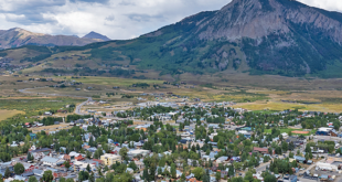
The Gunnison County Planning Commission is wondering just how far its authority will go in a review of the development being proposed at Wilder on the Taylor, an exclusive subdivision east of Almont.
The developers of Wilder are proposing a second phase to the 2,000-acre ranch development that will add four lots of between 35 and nearly 80 acres on the south side of the Taylor River. County planners have to review developers plans for a road through the area.
The question is: How far does the county’s authority over the road’s placement go in determining where homes can be built on each of the lots? The planning commissioners are hoping to get the answer from county staff at an upcoming work session that has yet to be scheduled.
“It’s not clear what the scope of our regulatory authority is on this,” planning commissioner Richard Karas said, “and it would be helpful before we get too far into this, as it’s a concern for us and for the applicant.”
Acknowledging the limits of authority Karas mentioned, Wilder planner Julie Ann Woods responded, “Very much so. Thank you.”
Colorado law allows land owners to divide property into tracts of 35 acres or more with little oversight from counties, which only get to apply road and bridge standards on the property and do their best to keep development out of hazardous areas. Beyond that, the county’s line of authority is quite blurry.
“Some people have taken the position that the county has no oversight, because it is a 35-acre development,” assistant planning director Neal Starkebaum said. “Historically we have not followed that track, because presumably there is a nexus between the development of the road, the development of driveways and the construction on the homesite.”
The county has asked the development’s planners to identify broad building zones on each of the lots, but without much to show for it.
“We had indicated that we’re really not wanting to specify [building] envelopes because we’re not sure who will want to build where,” Woods said. “Your point was that you want to make sure that there’s a place to build on every one of those lots.”
So the Wilder planners developed a map that identifies “no-build” zones in areas that are at risk of wildfire or rockslides, or in the path of the heaviest wildlife migration, which were the biggest concerns for the Planning Commission.
The development at Wilder has gotten the attention of the Colorado Division of Wildlife, which wrote a letter to the development’s planners and to the county detailing some serious concerns they had with the potential impacts Wilder’s second phase of development could have on wildlife, particularly a critical elk migration corridor.
In part, the letter reads, “Phase II confounds [the Division’s] concern to an even greater level by adding four more home sites in the narrowest section of the corridor, and constructing a serpentine road that will meander the width of the corridor through the greater part of its southern end. It is probable that this intensive amount of development will result in the abandonment of this corridor by migrating elk.”
To address the DOW’s concerns, engineer Jerry Burgess explained that the developers have applied for a waiver to the standard that limits the pitch of a road to less than 11 percent. He said the waiver, if granted, would allow the road to be less “serpentine” and therefore less of an impact to the elk, without making it “difficult to maintain or negotiate.”
Woods then showed the commissioners a map that defined the areas most likely to be used by migrating elk as off-limits to development. Woods said Wilder owner Jackson Shaw told her that the part of phase two known to be in severe wildfire danger should be removed from the areas available for development.
Commissioner John Messner told Woods, “I’m going to ask the DOW if the no-build zones are going to mitigate the concerns with wildlife, and if they tell me no, then that’s going to be a problem.”
Assistant planning director Neal Starkebaum reminded the commissioners, “Within the Division’s letter, although they identify some recommendations for mitigation, they said ‘given the topography of the area…we don’t see an alternative to mitigate impacts to the wildlife.’” Then he pointed to the part of the county’s Land Use Resolution that requires developers to avoid road construction through sensitive wildlife habitat.
After hearing more about the planning commissioner’s concerns, Woods said, “I want to provide you with some answers [about how to address the concerns]. I just want to know where the target is. We need to know specifically what we’re trying to address.”
The commissioners will be able to express their concerns better within the confines of the law, after it gets a briefing on 35-plus-acre development from the county planning director or county attorney. That meeting has not yet been scheduled.