Not time to worry yet
The snowpack around the Gunnison Basin has begun to slip below normal levels, thanks to unseasonably warm weather and a dry spell. But according to local water and snow experts, the time to worry hasn’t arrived just yet.
Frank Kugel, general manager for the Upper Gunnison River Water Conservancy District, uses data from five SNOTEL sites scattered around the Upper Gunnison Basin to gauge the state of the area snowpack.
“As of [Tuesday morning, January 20], they are showing a total 96 percent of normal snowpack, which is good but it was definitely better a couple of weeks ago,” Kugel said. A series of storms around Christmas gave a boost to the snowpack, but the lack of precipitation since then and the warm weather have caused the numbers to slip.
“I’ve heard reports of snow melting [or settling] as quickly as an inch per day in the Crested Butte area over the last couple of weeks,” Kugel continued, explaining that an inversion seems to have settled into the valley. Gunnison has tended to stay cold and fogged in, whereas higher elevations have reached temperatures as high as 40 degrees.
billy barr, business manager for Rocky Mountain Biological Laboratory, has observed similar patterns in Gothic.
He’s been keeping snowpack records since 1974, and his data shows that the townsite’s snowfall is 19 percent below average and snowpack is 25 percent below average. That in and of itself isn’t too concerning yet.
“This winter is below average a bit, but it’s kind of early,” barr said. “People always think the middle of January is deep winter, but things are usually just getting started. All it would take is one semi-decent storm and the snowpack would be above average.”
The numbers, barr explained, don’t mean as much in January as they do later in the season. In Gothic, the average snowpack for the month is 166.8 inches—20 percent of that is less than 35 inches. By contrast, 20 percent of an entire season would be more than 85 inches. A good storm in the next few weeks could still make up the difference pretty quickly, and that’s certainly possible, given that February tends to be the “biggest snow month” in Gothic, followed by January and March.
What’s even more striking for barr is this season’s warm weather. There have been 10 record highs for daily temperatures so far. “Forty degrees this time of year used to be hot, and now it’s not uncommon. Today [Monday, January 19] it’s up to 38 already, which is only a couple degrees from a record,” he said.
Those warm temperatures cause the snowpack to settle, though not necessarily melt outright. And while that’s not great for winter recreation, it’s a silver lining when it comes to snow water content and the region’s water supply. “Settling makes for a denser snowpack with less height, but it doesn’t really affect snow water content,” barr said.
So far, water levels around the basin seem to be in good shape. Kugel said Taylor Park Reservoir is at 75 percent of capacity, which is above average for this time of year, and Blue Mesa Reservoir is right at average. And while ice makes it difficult to measure inflows into the Taylor Park Reservoir, the inflows appear to be either average or slightly above average.
“We also had good fall precipitation, which would indicate soil moistures are average if not better, so overall the water supply is encouraging, despite the lack of snow the last few weeks,” Kugel said.
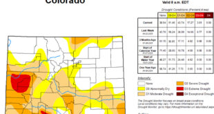
Compared to the rest of the state, the conditions of the local snowpack could certainly be worse. According to a report from the water center at Colorado Mesa University, snow along the I-70 corridor has tipped that region’s snowpack to above normal water content but areas in the southwestern corner of the state are falling as low as 70 percent and 64 percent of normal.
“The Colorado river basins with the skimpiest snowpacks have already been shortchanged for several years in a row,” according to the report. By contrast, the local basin seems to be in decent shape. But a turning point is approaching.
According to Kugel, snowfall generally peaks around the second week of April in the Upper Gunnison Basin. That puts the winter about half-way through the accumulation period, and while that means there is time to catch up, more snow is needed soon. February will be a telling month, and the short-term forecast isn’t optimistic.
Joel Gratz, meteorologist for OpenSnow, wasn’t able to share much good news for Crested Butte and predicted only a couple of dustings over the next two weeks. “Most of the storms are heading north well into Canada and then down the east side of the Rockies, which favors the mountains in northern Colorado (along and north of I-70) if storms make it close enough to Colorado to bring snow,” Gratz said.
In spite of the short-term forecast, however, Kugel sees some reason for encouragement. “The fact that we’re close to average is encouraging, and there is a long-range forecast that calls for average temperatures and above-average precipitation for February through April. That offers some hope,” Kugel said.
To view seasonal and long-term snowpack data for Gothic, visit www.gothicwx.org. The Upper Gunnison River Water Conservancy District website also has links to information like the long-term weather forecast and the Colorado drought monitor. Visit www.ugrwcd.org.
 The Crested Butte News Serving the Gunnison Valley since 1999


