The Crested Butte News Serving the Gunnison Valley since 1999

Only viable routes are along the highway…
By Katherine Nettles
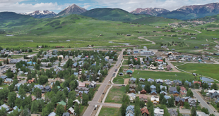
Gunnison County hosted an open house in Crested Butte last week to share its progress in planning and eventually developing a multimodal recreation path between the town of Crested Butte and Crested Butte South. The open house showcased work the county has done over the past several months to determine where a potential trail could go, how it would cross other roadways and the Slate River and what obstacles might need to be overcome before moving to a design and budgeting phase in the coming months. Not everyone was happy with the progress so far, particularly the county’s determination that the trail will have to go alongside Highway 135 using the Colorado Department of Transportation (CDOT) right-of-way.
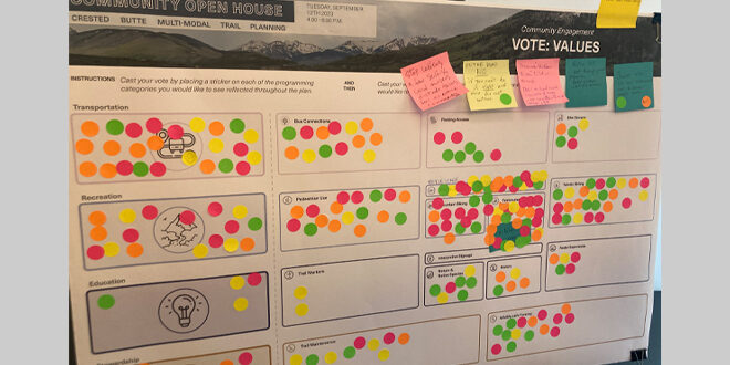
The open house was hosted by Gunnison County staff and representatives from Design Workshop, the design firm enlisted to help the county with the community engagement and trail design, at the Crested Butte Center for the Arts. The event included several interactive stations for attendees to explore, including storyboard posters with an overall site analysis, three different potential routes for the trail to take and a list of goals and values for the project.
The county has had a Crested Butte to Crested Butte South recreation trail on its priorities list for more than a decade and county commissioners have placed it on their capital improvement plan and strategic plan since 2022 to provide a multimodal alternative for commuters along Highway 135, reduce vehicular travel and greenhouse gas emissions and to connect some of the neighborhoods between the two points.
The persistent barrier to the trail since it was first discussed several decades ago is that the large swaths of land between Crested Butte South and Brush Creek are mostly privately owned. Any route through the various properties would require an easement or land purchase from each landowner, and that barrier is evidently still in place.
The open house showed three different trail alignment alternatives the county has deemed most likely to work based on land surveys and discussions with private landowners, public land managers and CDOT this summer.
The first route, “Alignment Alternative A” follows the east side of Highway 135 from the Hidden River Ranch subdivision to the Brush Creek Intersection, mostly using the CDOT right of way but also incorporating an existing recreation easement within the Hidden River Ranch subdivision. This includes one river crossing, four road crossings and seven driveway crossings.
The second route, “Alignment Alternative B” follows the east side of Highway 135 and makes use of the Hidden River Ranch easement but then crosses the highway south of Whetstone Industrial Park and back to the east side south of the Riverland Industrial Park for a total of three highway crossings, one river crossing and five driveway crossings.
The third route, “Alignment Alternative C” follows the east side of Highway 135 and makes use of the Hidden River Ranch easement, crosses the highway south of Whetstone Industrial Park, and remains on the west side of the highway until the Brush Creek intersection. This route includes one river crossing, three road crossings and seven driveway crossings.
A set of sticky notes and stickers were available for attendees to write suggestions and vote on their preferred trail route and preferred values (transportation, recreation, stewardship and/or education). They could also express interest in various amenities (benches, access to bus stops, signs, trash and recycling receptacles, pump track or bike jump features) for the route.
As visitors came and went throughout the two-hour session, some expressed disappointment with the county’s clear message that a path would run alongside Highway 135 in the highway right-of-way, and not be located further to the east within private property easements. Some attendees said they would not be interested in using such a path and were hoping for something more scenic away from the highway.
County staff say no other viable routes have been found, despite earnest efforts and one ranching family who offered to sell a portion of land to the county to enable a more scenic route from Crested Butte South. Gunnison County assistant manager for community and economic development Cathie Pagano said that as county staff and design representatives spoke with the property owners over the past several months, it became clear that a path through private properties had too many obstacles.
In an e-mail on Wednesday, September 13 following the open house, Pagano commented about the feedback she and others involved in the project heard from attendees.
“One of the questions that we heard last night was why the trail alignments are only in the highway right-of-way and not on private property. While we agree that an off-highway alignment would in many ways be a better user experience we were unable to identify a viable alignment on private property. While we did have a landowner willing to sell a portion of property to the county for an alignment, we had many other landowners that were not interested in a trail crossing their private property,” wrote Pagano.
“County staff and the consultant team did meet with a number of landowners in the area about the possible location of a trail but were not able to find agreement for the location of a trail across multiple privately owned parcels and ultimately determined that there was not a feasible option on private property.”
While some attendees wrote messages on the storyboards suggesting eminent domain, or government taking property and converting it to public use, Pagano said that sort of extreme scenario would be divisive to landowners who are also members of the community, and it would be cost prohibitive as the county would have to pay market price for the land and likely get involved in litigation.
The alignment options can be viewed online in a survey that is open now through Tuesday, September 26 at https://designworkshop.co1.qualtrics.com/jfe/form/SV_0oHlBs8N7YkZn7w
The next steps for the project are to create an action plan, gather cost estimates and identify potential funding sources, which the project team has set a goal of beginning this month and finishing by December. A tentative goal is to share the final plan by the end of the year in another community engagement forum. More information can be found at https://www.gunnisoncounty.org/1048/Crested-Butte-to-Crested-Butte-South-mul.