The Crested Butte News Serving the Gunnison Valley since 1999

Formerly Nevada Ridge
By Kendra Walker
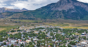
During the October 3 Mt. Crested Butte town council meeing, the town council reviewed a sketch plan application for the Crested Butte Ridge subdivision, formally the Nevada Ridge subdivision, and held a public hearing for public input. The sketch plan proposes to replat the existing lots into nine single-family lots and open space in two phases. The parcel is located off of Summit Road adjacent to CBMR near the West Wall Lift.
“Sketch plan is conceptual,” explained community development director Neal Starkebaum. “The intent is to identify potential issues and concerns, and how you’re going to mitigate them.”
The Nevada Ridge planned unit development (PUD) was originally approved in 2006. The original PUD consisted of 11 lots with 15 total units. The infrastructure, utilities, retaining wall and Nevada Summit Drive were partially constructed, but all work ceased when the project was abandoned sometime around 2007. All entitlements associated with the property are now expired.
Crested Butte Ridge, LLC is the new owner of the Nevada Ridge property. “My client was not the owner at time the entitlements were not renewed. He bought the property subsequent to that,” explained Jacob With of Law of the Rockies. “My client has come in hopes of reducing the density of what was previously approved and moving forward in a reasonably expeditious fashion, so that it is no longer in limbo sitting there on the skier hill.”
The council asked if the applicant has given any thought to a community housing component. With noted that his client would like to build the community housing on a separate piece of property, but has not yet found the appropriate parcel. “We don’t have a specific piece of property, which is what we would like to come back to you with,” said With. “The state of Mt. Crested Butte is there’s not a whole lot of available land to build community housing.” He requested that the town keep them posted on any opportunities that become available for them to develop. “We’re stumped internally on how to do it. If you have any opportunities for us to help with or participate, we’re all ears.”
There was no one in attendance for comment for the public hearing, however, the town council took into consideration public comments submitted for Planning Commission review in August.
The U.S. Forest Service Gunnison Ranger District submitted a letter regarding the lack of defined setback for development from the common property boundary line between the National Forest and Crested Butte Ridge LLC.
“The National Forest land adjacent to the private land in the Sketch Plan is comprised of steep, unstable, and wet soils located uphill of the proposed Crested Butte Ridge development. This raises concerns that work downhill or underneath the property boundary on private land will cause slumping, rotational slumps, or mass wasting events that could result in landslides of National Forest land onto private lands at lower elevations,” wrote Gunnison Ranger District realty specialist Jon Hare. “To mitigate these potential impacts – the USFS would like to request a 3:1 slope requirement for disturbance on private land adjacent to the NF boundary or a defined setback determined by Professional Engineer to mitigate the potential that work on the downhill private land causes National Forest land to landslide in the future.”
Summit subdivision property owners Casey and Megan Schorr also wrote a letter expressing their concern with how one of the proposed lots would impact the existing skier access and proposed adding a better skier easement to the boundary of lot 7.
The council approved the sketch plan and the review process will now start with a submittal of preliminary subdivision and preliminary PUD plans. As part of the approval, the council included the following condition:
“The applicant shall pay particular attention to the following items at Preliminary Plan submittal: a. New or updated geologic and/or geotechnical engineering analysis of the geologic hazards present on the property, with studies including data collection during spring run-off; b. Engineering analysis, assessment and evaluation of the rock retaining walls and viability of rehabilitation or replacement; c. Evaluation of existing utility infrastructure, including existing water and sewer lines, in coordination with the Mt. Crested Butte Water and Sanitation District; d. Storm water management and drainage plans; e. Address the management of noxious weeds; f. New wetlands delineation for the wetlands on the property; g. A Community Housing Plan; h. Address United States Forest Service, August 31, 2023, comments; i. Investigation of de-watering systems.”