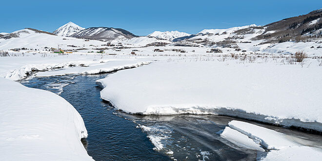
Filling in measurement gaps and improving water cycle predictions
[ By Katherine Nettles ]
Representatives from an ongoing Upper Gunnison/East River Valley atmosphere study have reported that research for the project is going well and the valley is an ideal location for major progress on a global research level. Before the end of the ski season, Heath Powers from the Los Alamos National Laboratory and Ken Williams, a geologist with the Berkeley National Laboratory presented their oversight to Gunnison County commissioners of a long running research project funded by the U.S. Department of Energy that is focused on the future of water in the United States.
The National Laboratories are conducting a Surface Atmospheric Integrated Laboratory (SAIL) project, a two-year study of the atmosphere in the East River Valley, as previously reported in the Crested Butte News. The study involves close collaboration with the Rocky Mountain Biological Laboratory (RMBL) and Colorado State University.
“What’s so great about working in the Upper Gunnison Valley is that it’s reflective or emblematic of mountain systems throughout the United States,” said Williams. From the sage in Gunnison to the high alpine areas above treeline, to the bedrock composition of the surrounding areas, he said the complex terrain of the valley represents an incredible place to explore the processes that impact water flows.
“We could not have found a better place to perform our research than the Upper Gunnison,” said Williams. The teams are studying the landscapes to understand how plants and soils, forests and bedrock take on the “hand-offs of water” from snowmelt and other precipitation, and ultimately release it back into the atmosphere. He said that groundwater inputs have shown a 55 to 60% return rate.
“What we’ve seen to date is really surprising. We’ve seen decreases in ground water elevation over broad spatial areas of upwards of six to seven or eight feet over the past few years,” he said of natural variations. The project is linking the network of ground-based and atmospheric measurements to develop numerical models.
“And while that sounds fancy and sophisticated, it’s critically important because it’s those models that allow you to take individual data points and put them within a context that allows you to understand a system,” said Williams.
Powers echoed that the SAIL project will be instrumental in filling in measurement gaps around the western portion of Colorado, and thereby improving predictions of the water cycles and better understanding the Colorado River Basin. “We are basically flying blind in the headwaters of the headwater state,” he said of the need for the research. “Also, this research will be representative of mountainous areas around the world,” said Powers. “This will truly help us across the globe.”
Powers thanked RMBL executive director Ian Billick, who also attended the presentation, for the collaboration. Billick in turn commented on how important the county staff’s support has been in placing the project research apparatus on various county plots of land. “What we do is very unusual, it’s unique and it’s not something people usually have a lot of experience with. The county staff have been very generous…I recognize that sometimes we’ve been a little challenging. We’re a square peg trying to fit in a round glass,” he said.
County commissioner chair Jonathan Houck suggested a future work session with RMBL and the commissioners would be instrumental. “Some of the opportunities that happen in this county and this watershed are pretty unique. And they contribute way outside of what’s going on here,” he said.
“The scientific community has found a place here that appreciates science, believes in science and wants to see these opportunities utilized for things that are important to all of us,” said Houck.
 The Crested Butte News Serving the Gunnison Valley since 1999


